Explore
Featured
Recent
Articles
Topics
Login
Upload
Featured
Recent
Articles
Topics
Login
Upload
Search Results for 'elevation line'
elevation line published presentations and documents on DocSlides.
Angle of elevation and depression
by gagnon
Warm Up. 1.. . Identify the pairs of alternate . ...
8.4 Angles of Elevation and Depression
by cheryl-pisano
-Quiz Friday over Pythagorean Theorem/Special Rig...
Angles of elevation & depression
by alyssa
Solve problems involving angles of elevation and a...
MnTOPO – A place to view, print, and download LiDAR Elevation Data
by cheryl-pisano
MnTOPO – A place to view, print, and download L...
Day 3: Angles of Elevation and
by natalia-silvester
Depression. 1/14 and 1/15. EQ: . How do we draw ....
Do Now Solve the right triangle given the following information:
by cora
. Section 2.4. Solving Right Triangles. Objectiv...
Topography
by tatiana-dople
A . map . showing the surface features of an area...
Applications of Trig Functions
by kittie-lecroy
Angle of Elevation. : the angle from the line of ...
3D and Surface/Terrain Analysis
by faustina-dinatale
in partnership with:. With support from:. NSF DUE...
Office Hours
by tatyana-admore
Mon: 11:30 AM to 12:30 PM & 1:45 PM to 3:0...
8.4 Angles of Elevation and Depression
by alexa-scheidler
Angle of Elevation: the angle formed by a horizo...
Contour Lines
by min-jolicoeur
Contour lines are lines drawn on a map that conne...
MnTOPO – A place to view, print, and download LiDAR Eleva
by karlyn-bohler
Accessing and Viewing Minnesota LiDAR Data On-lin...
Graphs of Piecewise Linear Functions
by cheryl-pisano
Define appropriate quantities from a situation, c...
Graphs of Piecewise Linear Functions
by marina-yarberry
Define appropriate quantities from a situation, c...
Working Drawings: Exterior Elevations
by liane-varnes
CMCE 1110 Construction Drawings. Professor Anders...
UNIT 4: MAPPING THE EARTH
by anastasia
After . Unit . 4 you should be able to:. Accuratel...
Right Triangle Trig Applications
by helene
Angles of Elevation and Depression. Dr. Shildneck....
Do Now: In your notes, list all the different types of landforms/features of Earth that you can
by jasmine
Example: Hills. Mapping Earth. Topography. :. The ...
Determining the Antarctic Ice Sheet Grounding Line with
by debby-jeon
Photoclinometry. using . LANDSat. Imagery and ....
As we go through the power point, please do the followin
by min-jolicoeur
Match your cards.. Take notes in your science not...
Integers & Using
by kittie-lecroy
the Number Line. Comparing Rational Numbers. Inte...
The study of the shapes and features of the Earth’s su
by alexa-scheidler
Topography. Shows the three dimensional shape ...
As we go through the power point, please do
by marina-yarberry
the following. :. Match your . cards.. Take notes...
MAP READING Terminal Learning Objective:
by danika-pritchard
During this block of instruction you will receive...
Surveying Terms Instructed by:
by briana-ranney
Sohail Manzoor Tarar. Department . of . min...
MAP READING Terminal Learning Objective:
by mitsue-stanley
MAP READING Terminal Learning Objective: During t...
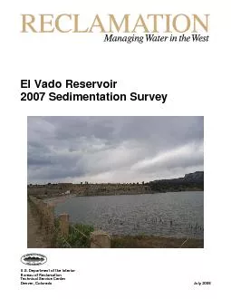
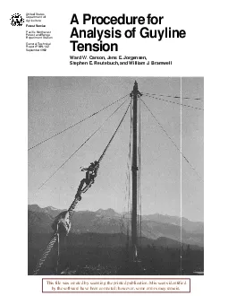
US Department of the Interior Bureau of Reclamation Technical Servic
by cora
U.S. Department of the Interior Bureau of Reclamat...
Today 10/09/14 period
by fauna
1. Attendance / seating chart. Say hi to MR. . BEA...
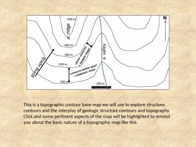
This is a topographic contour base map we will use to explore structure contours and the interplay
by natalie
a ridge. a valley. g. oing uphill. closer . cont...
Drawing Rectangle tools
by riley
Lecture . 15. Rectangle tool ・First . example. ...
a research
by lily
of Agriculture com puter prog ramslprog ram i ng ...
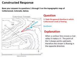
Question Explanation
by mitsue-stanley
When a contour line crosses a river valley it mak...
Topographic Map Skills
by jane-oiler
Topographic notes. Topographic Map-includes conto...
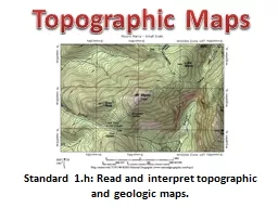
Standard 1.h: Read and interpret topographic and geologic m
by briana-ranney
Topographic Maps. Contouring. Topographic contour...
School of Earth and Environment
by calandra-battersby
Exercise set 2:. The 3 point problem. To view th...
This is a topographic contour base map we will use to explo
by debby-jeon
a ridge. a valley. g. oing uphill. closer . con...
5.1: Rate of Change and Slope
by tatiana-dople
Rate of change:. Shows the relationship between ...
Surveying I.
by ellena-manuel
Lecture 2.. Sz. Rózsa: . Surveying. I. – . Le...
Load More...